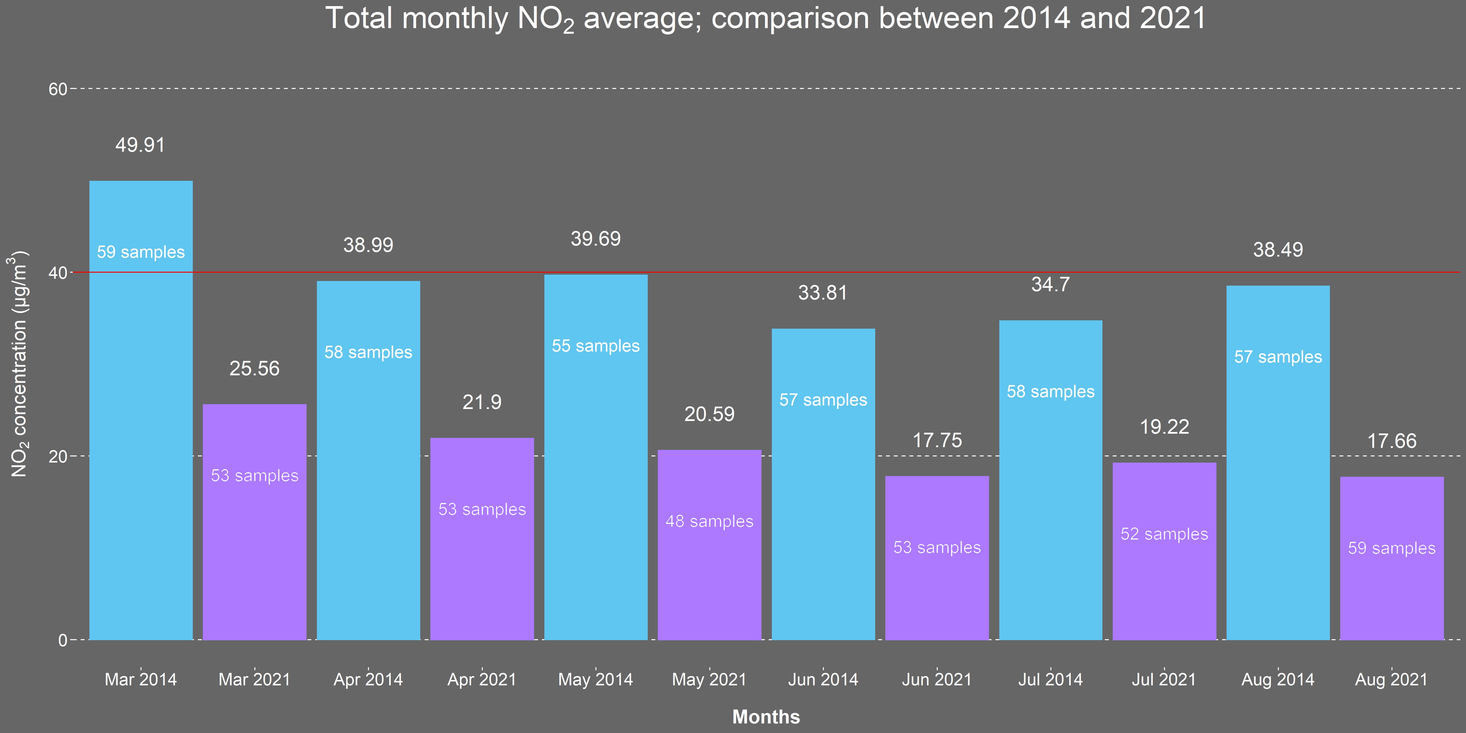
Levels of particulate matter and nitrogen dioxide can be a concern in urban areas. In 2014, a comprehensive one-year Air Quality Citizen Science monitoring project commissioned by The City of London Corporation and led by Mapping for Change, was undertaken by residents of the Barbican Estate. ‘Science in the City’ aimed to increase understanding amongst residents about air pollution, its causes, effects and how it varies over space and time. Residents were consulted on any actions they would like to see taken over subsequent years to improve local air quality.
Our Role
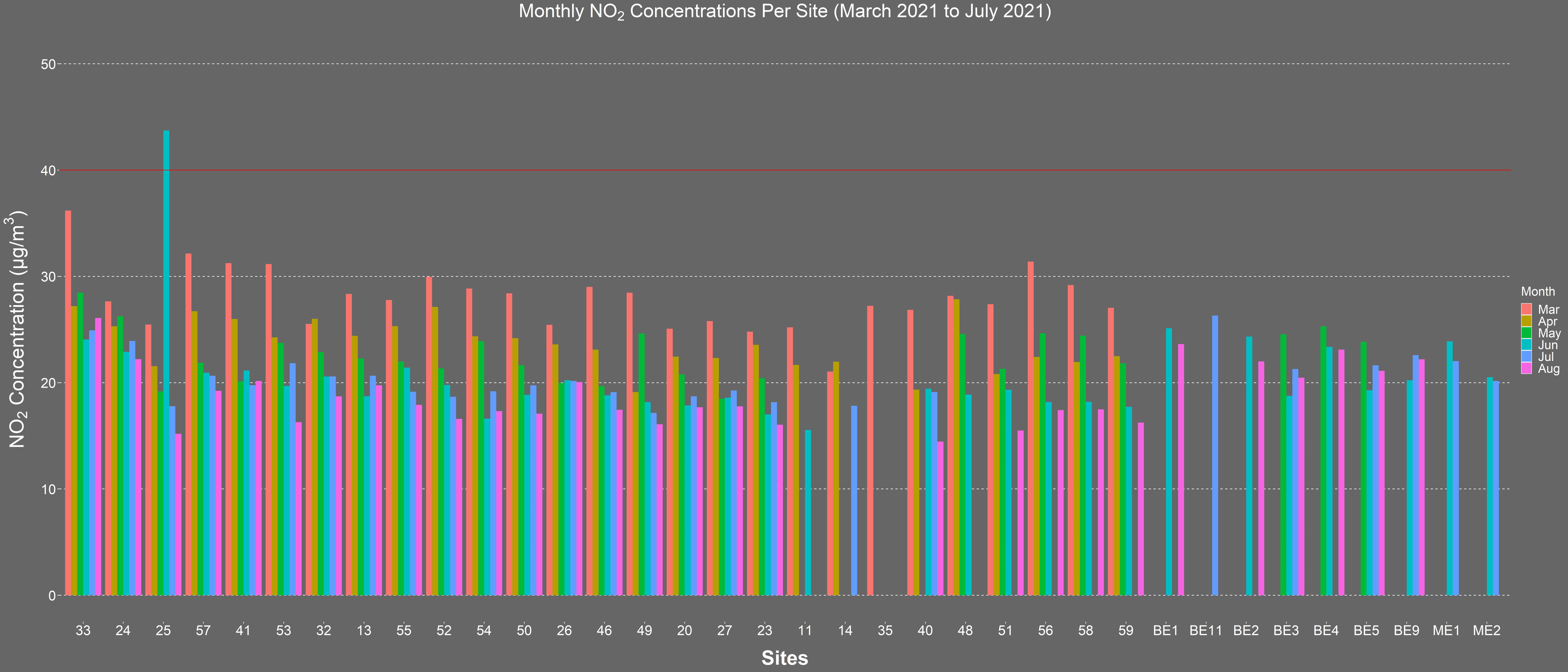
Now, six years later, after implementing several of the suggested initiatives around the Barbican, including a Low Emission Neighbourhood and the Mayor of London Ultra Low Emission Zone, The City of London Corporation and Mapping for Change are teaming up once again to repeat and broaden this research. Mapping for Change is working with residents of two housing estates in the centre of the capital to monitor nitrogen dioxide levels over the course of a year. This citizen science project has been co-designed with the residents to ensure the outputs are relevant and useful to them both in reducing their personal exposure to air pollution and in evaluating the impact of the changes implemented. The work aims to raise awareness of air pollution and demonstrate the impact that citizen science and resident participation can have on environmental issues. The project will run from March 2021- February 2022.
Documentary: Science in the City
Related Projects
Hackney Wick Community Map
Hackney Wick is a community situated on the boundary of the 2012 Olympic Park within the London Borough of Hackney. Hackney Wick is just one of the many communities facing considerable change as a result of major development and regeneration plans. Developments to the Olympic site resulted in the loss of facilities used by local residents, such as the local playing field and allotments. There was continued mixed sentiment about the development and the legacy which they were to inherit.
How to Spend a Million? Northfleet Big Local Trust
In 2012, the Big Lottery Fund in England invested £1 million in 150 neighbourhoods for its Big Local initiative. Northfleet, Kent, was one of the first 50 to be selected. The grant aimed to equip local communities with skills and tools to identify key areas and issues where action was reqiored in their area.
Putting Ourselves on the Map
Mapping for Change in collaboration with the Humanities Education Centre (HEC) and local specialist on learning and ‘place’ Maggie Hewitt, worked with three schools in Tower Hamlets (Columbia School Community Map, Arnhem Wharf School Community Map and John Scurr School Community Map) to pilot a brand new process in which Year 4 pupils develop personalised maps of their local area with their own likes, memories and views on change.

