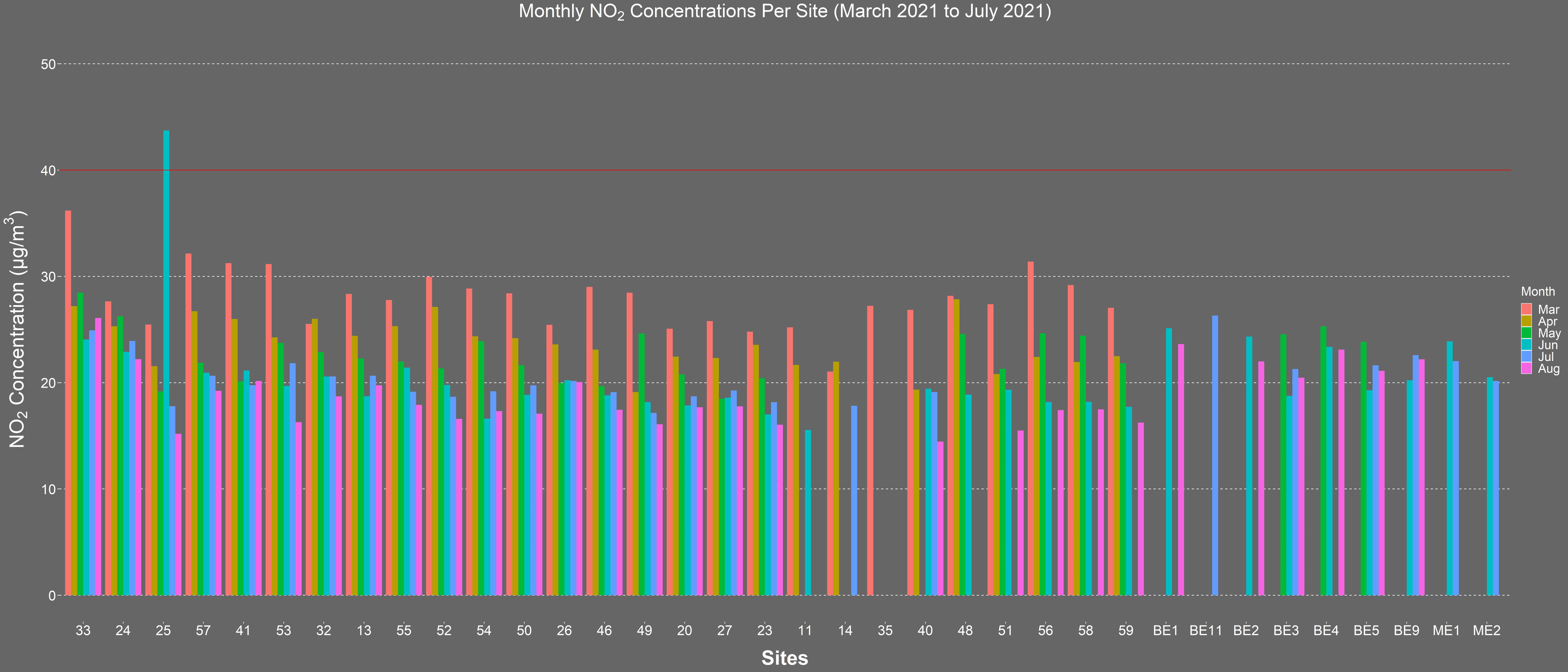
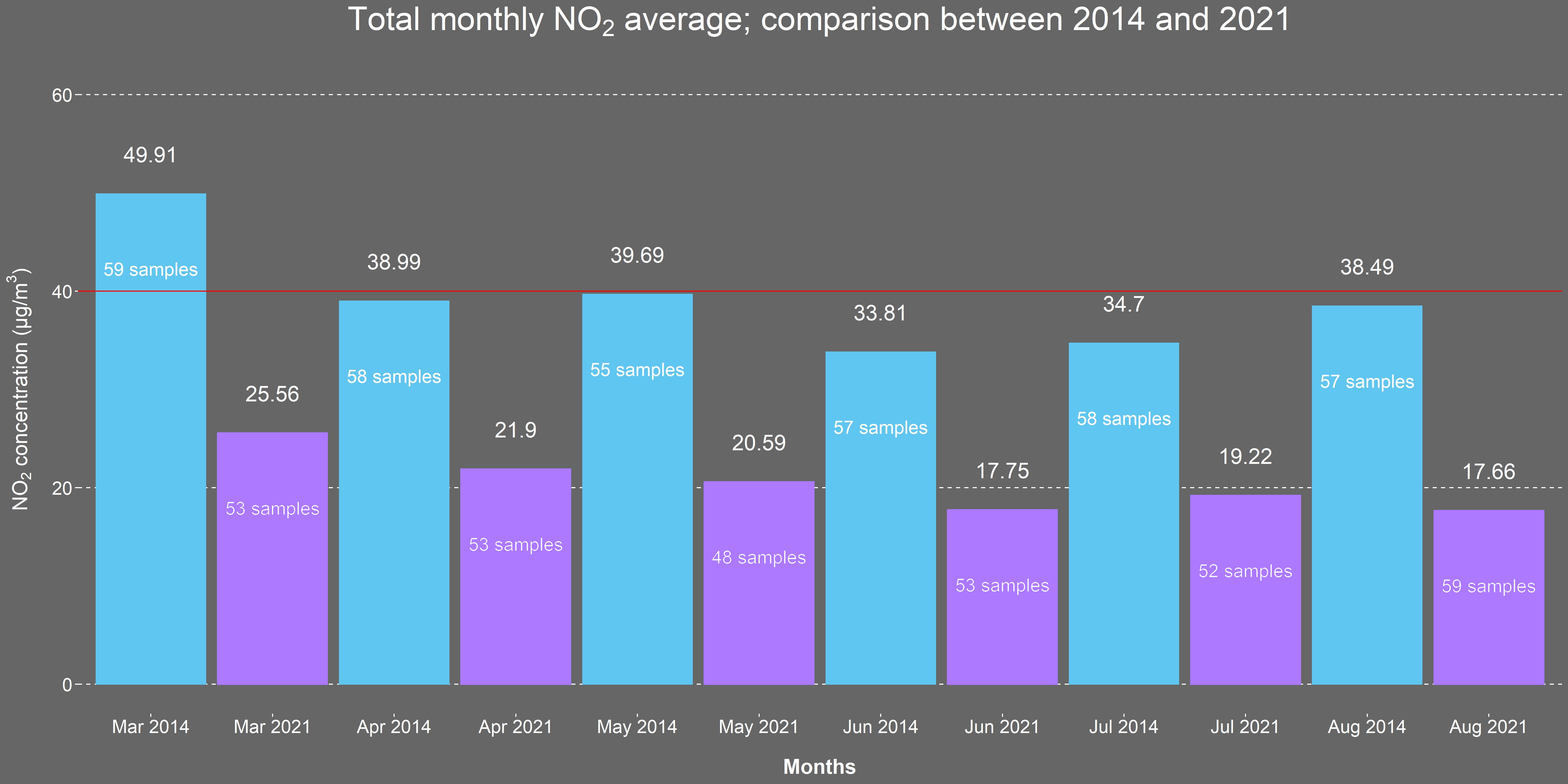
Levels of particulate matter and nitrogen dioxide can be a concern in urban areas. In 2014, a comprehensive one-year Air Quality Citizen Science monitoring project commissioned by The City of London Corporation and led by Mapping for Change, was undertaken by residents of the Barbican Estate. ‘Science in the City’ aimed to increase understanding amongst residents about air pollution, its causes, effects and how it varies over space and time. Residents were consulted on any actions they would like to see taken over subsequent years to improve local air quality.
Our Role
Now, six years later, after implementing several of the suggested initiatives around the Barbican, including a Low Emission Neighbourhood and the Mayor of London Ultra Low Emission Zone, The City of London Corporation and Mapping for Change are teaming up once again to repeat and broaden this research. Mapping for Change is working with residents of two housing estates in the centre of the capital to monitor nitrogen dioxide levels over the course of a year. This citizen science project has been co-designed with the residents to ensure the outputs are relevant and useful to them both in reducing their personal exposure to air pollution and in evaluating the impact of the changes implemented. The work aims to raise awareness of air pollution and demonstrate the impact that citizen science and resident participation can have on environmental issues. The project will run from March 2021- February 2022.
Documentary: Science in the City


Related Projects
Evaluating People Zones Leicestershire
Through engaging residents in an Asset-Based Community Development Approach, our research for People Zones Leicestershire generated lasting resources which helped identify opportunities for hyper localised community initiatives. Now, we’re returning to evaluate the program’s impact, aiming to provide concrete evidence of its effectiveness in reducing crime and promoting community well-being.
How to Spend a Million? Northfleet Big Local Trust
In 2012, the Big Lottery Fund in England invested £1 million in 150 neighbourhoods for its Big Local initiative. Northfleet, Kent, was one of the first 50 to be selected. The grant aimed to equip local communities with skills and tools to identify key areas and issues where action was reqiored in their area.
MyAccessible.EU
MyAccessible.EU is a three year research project funded by the European Commission. It aims to make cities’ built environment more accessible for disabled and older people by challenging social attitudes, raising awareness and delivering assistive mobile applications. These mobile applications will provide tools for collectively gathering and sharing information about accessibility of public spaces.