The research, Analysing Active Mobility through Participatory Urbanism, deals with the practical application of emerging trends in participatory urbanism, as applied to the understanding of the urban environment issues of active mobility in Malta. Through citizen science, neogeography and volunteered geographic information (VGI), this research sought to analyse if and how community knowledge can be considered a viable option for understanding the urban environment issues for bicycle users in Malta.
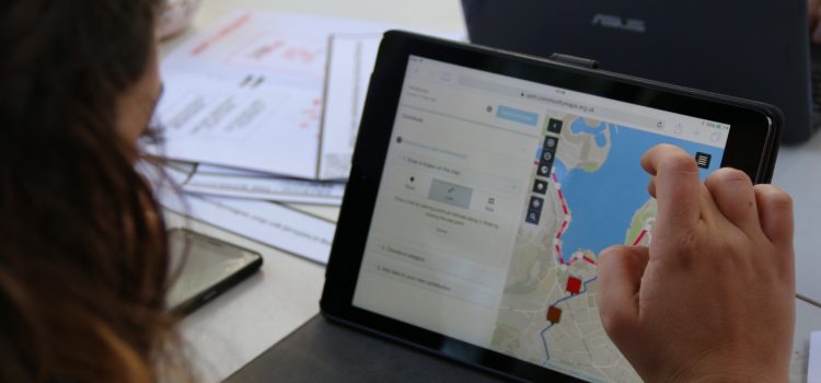
Central to this study has been the implementation of a citizen science initiative entitled bike&map, which consisted of a workshop during which physical mapping was complemented with a digital interactive online mapping exercise through Mapping for Change. The case study, carried out over 14-days, attracted 342 VGI contributions, relating mainly to Malta’s Principal Urban Area (PUA).

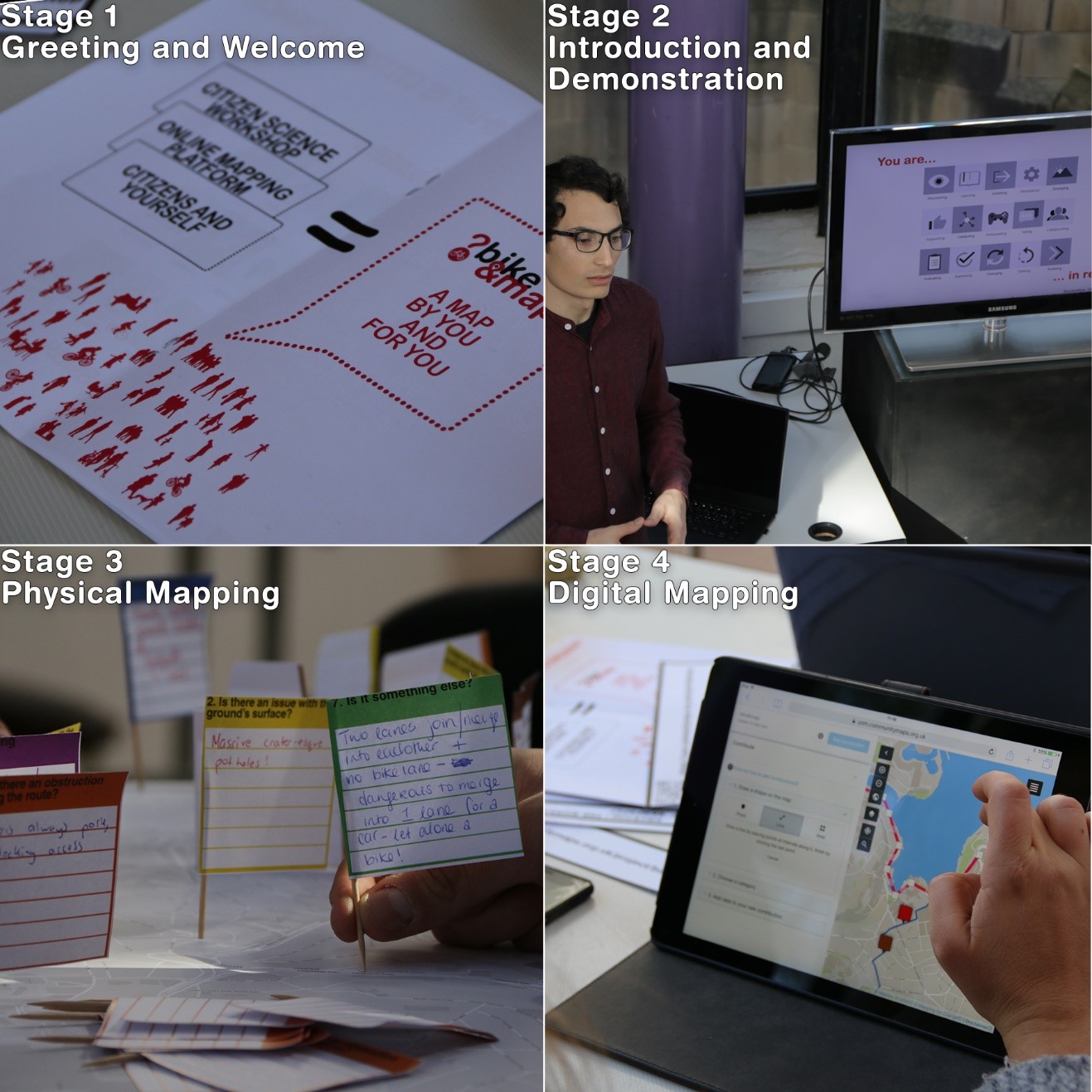
Various graphic material for the praxis. Phase 2- The Workshop. Images ©Steve Cassar Montebello.
The participatory urbanism process targeted an existing community group, The Bicycling Advocacy Group (BAG), a non-profit voluntary community group that is geared towards citizens who use the bicycle as a mode of transport. This process consisted of three distinct yet related stages. Stage 1 & 2 consisted of a welcome and introduction stage, where the citizens were introduced to the research topic, the methods and Mapping for Change’s Community Maps platform. Stage 3 consisted of physical mapping to physically map contributions. The fourth stage, the digital mapping stage saw the citizens mapping and iterating the existing online mapping platform. Using MfC allowed for quick and live iteration of the digital online platform, which was paramount to the research, as the data structure of bike&map was a result of a participatory citizen science process. The emerging methods of participatory urbanism implemented demonstrate the flexibility of such tools.
The contributions to the online platform varied in content, detail, expertise, and geographic familiarity. Issues also varied in scale, some related to minor changes in level along routes, or road gratings parallel to the direction of movement, and others dealt with entire sections of areas, roads and intersections.
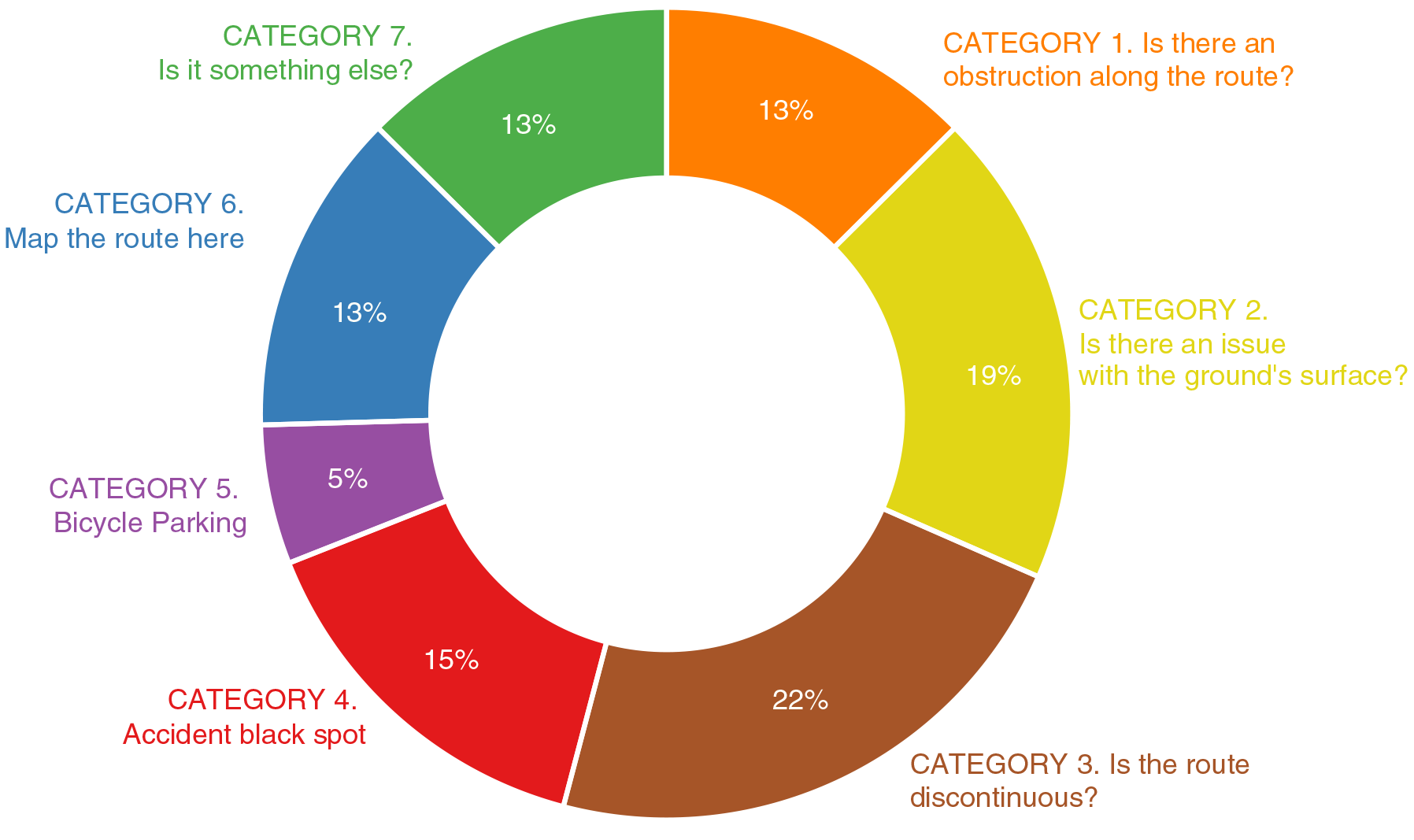
Contributions to bike&map after 14-days
It is suggested that community knowledge can bridge the gap between technical knowledge and the on-the-ground reality. The outcome is that there are multiple forms of knowledge that can influence the understanding of the urban environment in a meaningful manner, amongst which, technical and community knowledge are considered. The citizen science process, through the implementation of participatory citizen science, neogeography and crowdsourcing in an urban design & planning context, can therefore be termed mutualistic urbanism.
The platform is still available for contributions.
Guest blog by Steve Cassar Montebello