In Nigeria, 70% of the population are involved in agriculture at a subsistence level. Most of their farming systems follow traditional methods, such as slash and burn, and are increasing their chemical dependence. These elements are key drivers of rising deforestation, land degradation and ecosystem loss, among others. In addition, the impact of climate variability has altered Nigeria’s rainfall and temperature regimes over the past decade.
Consequently, the Nigerian farm households are seeing their soil productive capacity significantly reduced, putting their livelihoods at risk. One of the alternatives is to foster a transition towards Climate Smart Agriculture (CSA), a productivity-enhancing, ecosystem-friendly and climate change resilient farming system.
In direct response to these major issues, we carried out a pilot project ‘Extreme Citizen Science in Agriculture (eCSAgri)’ from January to June 2021 to explore how digital tools (Sapelli, Community Maps and Spatial Decision Support Systems) could support smallholder farmers to report and to map farming issues in order to receive timely advice from extension officers and from other farmers. We also discussed and prototyped how the land use data and knowledge derived from these interactions (farmers-extension workers and farmers-farmers) could be appropriately processed, aggregated and visualised to support evidence-base decision-making processes.
Our colleague Marcos Moreu (ExCiteS research group, UCL) provided in-field support to our local partner, the Environmental and Economic Resource Centre (Nigeria), while we shared our contributions remotely. Around 15 farmers per community -from three communities situated in different agroecological zones- were engaged in the co-creation, prototyping and testing process, together with five extension workers from different local governments. Wider stakeholder groups including the Federal University of Agriculture Abeokuta, the Nigerian Meteorological Agency, the state Ministry of Environment, the Ogun State Agricultural Development Program Office and the Federal Ministry of Agriculture, joined a meeting that took place at the end of the project to understand the project achievements and to provide feedback.

The pilot results show an appetite to explore further uses of the methods and technologies proposed as well as the main challenges to scale those up, including technical and/or design issues, unequal participation or limited print, digital and map literacy. This pilot has enabled us to gain a better understanding of how technologies can be used in smallholder farm contexts in sub-Saharan Africa and to establish a solid professional relationship with EERCE.
This project has been funded by the UK Research and Innovation (UKRI).
For more detailed information about the pilot, the FPIC process and the prototypes, read Marcos Moreu’s blog post, it’s a master piece!
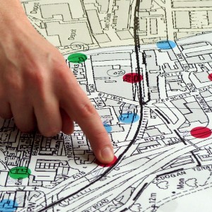
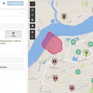
Maps
Maps can show you where you are. But a good map can also show you where you want to go, and how to get there.
With a map, you can communicate, analyse and enact change. We work with communities to achieve social and environmental change in their local area.
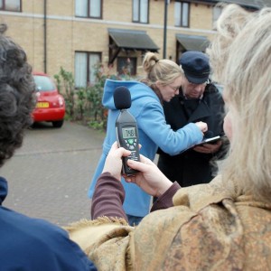
Citizen Science
Environmental problems affect us all. Citizen Science can give you a voice. Let’s collect the data we need to raise awareness and fight for change.
Low tech and affordable methods mean that everyone within a community can get involved and become a citizen scientist.
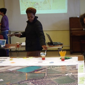
Community Engagement
Does your organisation work with community groups? We can design and implement a unique engagement approach, tailored to your particular requirements.
With over 15 years experience in the community and voluntary sector, we understand how to reach and involve people.
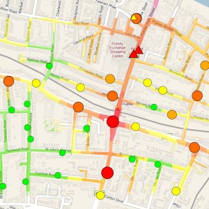
Map Visualisation & Analysis
Space is complicated. Map visualisation & analysis can help you to understand and discover what’s going on.
We have expertise in the use of Geographical Information Systems, and we can apply it to meet your needs.
Online Mapping Platforms
It’s good to collaborate. Contribute, share and discuss your ideas about the places that matter with Community Maps, our online participatory mapping platform.
Community Maps provides an effective tool for community and multi-stakeholder consultation across a range of projects and sectors.