Sun, sea and busy dual carriageways: an update on our community engagement in Southend-on-Sea, for the interdisciplinary research project, Street Mobility and Network Accessibility.
For many people, living near to a busy main road is simply a fact of life. However, as we grow older and less mobile, a number of factors begin to influence where we can and can’t go, and how we choose to get there. In Southend, the third of four case studies, we will be gathering perspectives from older people in order to assess the impact that major roads have on their movements around, and perceptions of, the local area.
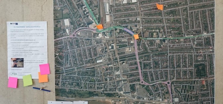
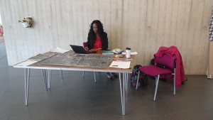
Mapping for Change have facilitated several workshops and drop-in sessions in key destinations around the town centre. Last week, we were in The Forum – a recently-constructed library and events space in the heart of Southend. By hiring a stall in the foyer, we were able to display large paper maps and aerial photographs of central Southend, and invite older residents to come and speak to us about their experiences. Quickly we became an established part of the scenery, with many people approaching in curiosity to discover what the ‘map ladies’ were up to.

Mapping for Change hired a stall in the foyer in order to display materials and interact with participants in a neutral community space
Maps help us to think about familiar areas in different or new ways. Mapping for Change specialise in participatory mapping, or the creation of alternative maps which incorporate quantitative or qualitative information from people who live or work there, for a range of academic and professional research projects. In Southend, we provided each participant with a unique paper map to document their perceptions and experiences of walking around the town centre. We’ve asked participants questions about where they like to go, routes that they choose to walk, and any places they make a habit of avoiding.
Around 40 participants have been involved so far, and several recurrent themes and locations are already beginning to emerge. In many cases, these reflect recent changes made to the built environment around Victoria Station. In 2011, the area was extensively redeveloped, and ‘shared space’ was created. Shared space is a style of urban design which removes demarcations between pavements and roadways, and aims to encourage motor vehicles to slow down and be more accommodating towards pedestrians. However, a sizable proportion of participants reported avoiding the shared space altogether due to fears it was unsafe. One respondent commented that this area was “like putting a child into a room full of knives; someone’s going to get hurt sooner or later”.
Over the coming months we will be organising more workshops in locations around Southend town centre. We may even venture down to the seafront! If you are interested in sharing your views, or coming along to one of our workshop events in the town, please contact info@mappingforchange.org.uk, or call 020 7679 2296.